


|
|
Note: "OLLP" at then end of a text block indicates the text was taken from On Location in Lone Pine by Dave Holland. |
Lone Pine Film History Museum
Lone Pine, Where the Real West Becomes the Reel West
Movies/Documentaries/TV Series Filmed in Owens Valley
The Western Stars |
|||
Louise Brooks 1906-1985 |
|||
Mary Carlisle 1912- |
|||
 |
Lili Damita 1904-1994 |
||
 |
Delores Del Rio 1905-1983 |
||
 |
|||
Yvonne De Carlo 1922-2007 |
|||
 |
|||
Dale Evans 1912-2001 |
|||
 |
|||
Virginia Brown Faire 1904-1980 |
|||
 |
|||
Helen Ferguson 1901-1977 |
|||
Lois Wilson 1894-1988 |
|||
Claire Trevor 1910-2000 |
|||
Thelma Todd 1906-1935 |
|||
Marie Mosquini 1899-1983 |
|||
 |
|||
Ruth Terry 1920- |
|||
Peggy Stewart 1923- |
|||
Eleanor Stewart 1913-2007 |
|||
 |
|||
Olive Fuller Golden 1896-1988 |
|||
 |
|||
Barbara Britton 1919-1980 |
|||
 |
|||
Mara Corday 1958- |
|||
 |
|||
Ruth Roland 1892-1937 |
|||
 |
|||
Iris Meredith 1915-1990 |
|||
 |
|||
 |
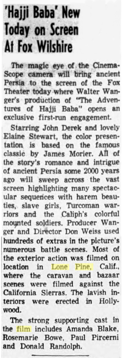 From the Venice Beach, CA "Evening Vanguard" of October 7, 1954 "Hajji Baba" new today on screen at Fox Wilshire - Shot on location in Lone Pine |

 |
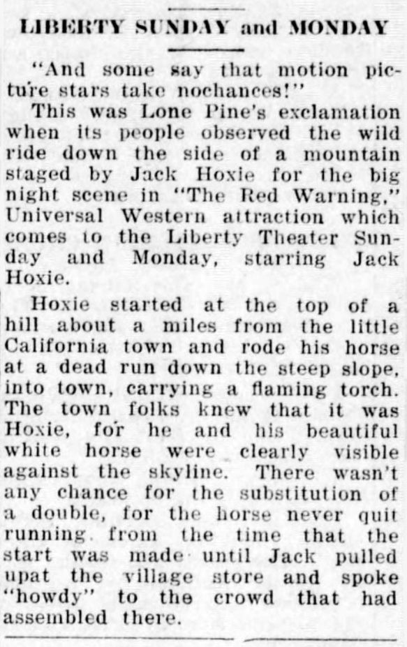 From the Ventura, CA "Ventura Free Press" of February 2, 1924 Jack Hoxie in "The Red Warning" filming in Lone Pine |
|
 |
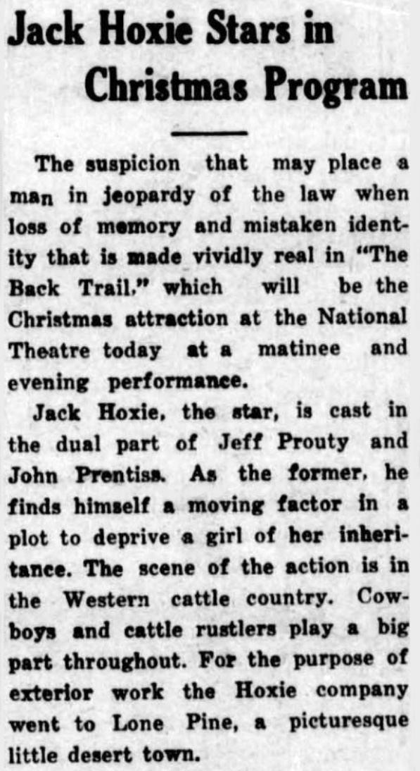 From "The Madera Mercury" of December 25, 1924 Jack Hoxie stars in Christmas program "The Back Trail" filmed in Lone Pine, CA. |
 |
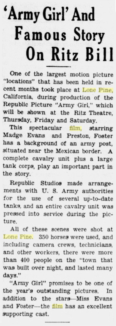 From Escondido, CA "The Times Advocate" of October 7, 1938. 350 horses used in the shooting of "Army Girl" in Lone Pine, CA. |
 |
As for "Lone Pine" itself, that name came from a mining party camped along the creek in 1860 (possibly the Dr. Darwin French party from Visalia which came through here that year on its way to look for Death Valley's legendary Lost Gunsight Mine. They didn't find that - no-one has yet - but did discover silver in the Coso range southeast of Olancha; maps still show a townsite of Darwin.) Whoever the miners were, they named the site "Lone Pine" after a tall Jeffrey pine standing where they pitched camp - Browning says it was where Lone Pine Creek and Tuttle Creek converged (if they did once join, it was obviously before the Los Angeles Aqueduct truncated them) - a lone Jeffrey pine long since washed away by flood, the history books say. OLLP |
The Brenkert Theater Projector
(Courtesy Museum of Western Film History)
Photos courtesy of Page Williams |
|
 Filming The Lone Ranger" in 1938 in the Alabama Hills |
 Early filming in the Alabama Hills. |
The RKO Camera Car
(Courtesy Museum of Western Film History)
Buck Jones Movies |
|||
 |
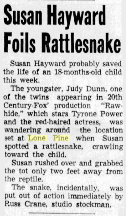 From the "South Gate Daily Press-Tribune" of March 3, 1950. Susan Hayward saves child's life from a rattlesnake filming on location in Lone Pine, CA |
When you head west toward the mountains from Lone Pine in and enter the canyon with those tall hills looming up on either side of you - you have already entered the Alabama Hills. The name does not just apply to the rock protrusions in the valley beyond. And it was in these rounded hills during the Civil War - 1863 to be exact - that Southern sympathizers discovered placer gold. At the time, a real go-get-'em Confederate cruiser, the Alabama, was in the process of sinking more than six million dollars worth of Norther shipping, so to celebrate her recent victories, the Johnny Rebs named their mines after her. Soon, the name applied to the entire range. The hill just before the "LP" one (the first one you pass, the one right by the "Alabama Hills" name monument) is called Hoodlums' Peak, Pete Olivas told me, because of the hoboes who camped there during the Depression. At its base, where there used to be a hobo jungle, you can still see remnants from an even earlier time, the exploratory beginnings of a mine shaft and the rock walls of dugouts from the mining days. And from the movie days, Olivas remembers seeing cowboy film star Ken Maynard ride a horse down its steep slopes, "dust and rocks just a 'flyin." As you enter the canyon, that small tunnel into the hill on the south side of the road is where the town's hardware stores stored their dynamite long ago. OLLP |
 Confederate cruise ship - CSS Alabama |
 |
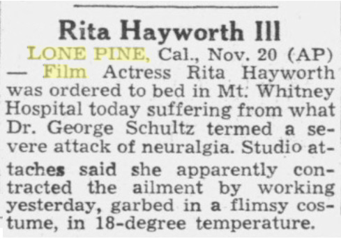 From Santa Rosa, CA - "The Press Democrat" of November 21, 1947 Film actress Rita Hayworth is recovering from an attack of neuralgia while filming in Lone Pine, CA |
 |
 |
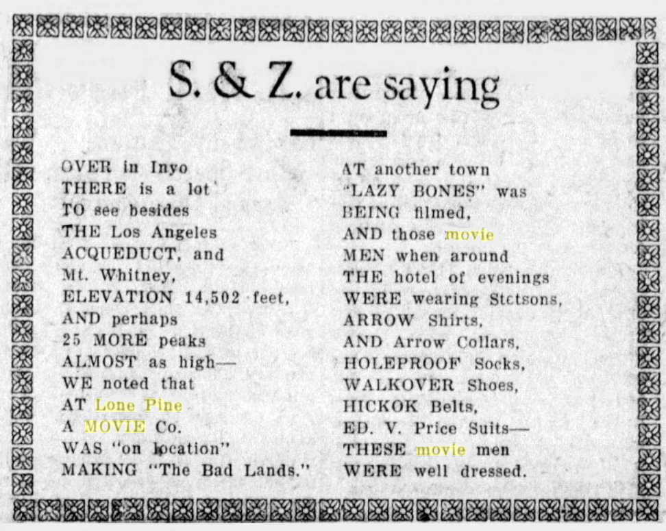 From the "Tulare Daily Advance" of June 12, 1925 On location in Owens Valley filming "The Bad Lands" in Lone Pine and "Lazy Bones" at another town. |
| Monache Meadows Cowboys | ||
Sam Lewis & Sierra Lady Pack Station |
||
| Ed Brown - Mt. Whitney Pack Trains Packer and Cowboy Poet | ||
More At the Movies ... in Lone Pine |
Sign Guestbook View Old Guest Book Entries Oct 1999 - Feb 2015 (MS Word) |
 CONTACT the Pigmy Packer |
View Guestbook View Old Guest Book Entries Oct 1999 - Feb 2015 (PDF) |


